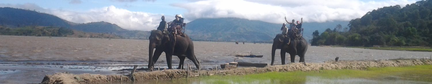

Sapa district
(or Sa Pa) is located in Lao Cai province, 350 km from Hanoi, close to the border with China. The Hoang Lien Son range of mountains dominates the district, which is at the eastern extremity of the Himalayas. This range includes Vietnam’s highest peak, Fansipan Mountain at 3,142m above sea level, and a vast area covered by thick forest, which is very rich in wildlife. The township of Sapa lies on a hill station at the attitude of about 1,600m and was built by the French into a famous summer resort with some hundred colonial villas which was well-known as “ Tonkin’s Alps” . The complicated terrain of Sapa including steeped high mountains with sharp cuts and large valleys, many streams of water in combination with sloped terraced paddies form magnificent scenery. Famous for its breathtaking landscapes, Sapa is also an ideal inhabitation for a great diversity of ethnic minority peoples. It is likely that, Sapa was first inhabited by highland minorities of H’mong and Zao groups who immigrated from southern provinces

of China, later came the Tay, Zay, and a small number of Xa Pho to form the 5 main ethnic groups which takes about 85% of the district’s population today. The Vietnamese, in small number, immigrated from lower land to the region, mainly living in town, working in government offices, schools, hospital or running their own mini hotels, shops, … while most other ethnic peoples live in small hamlets and villages scattering on the mountains and valleys throughout the district. Until middle of 20th Century, the H’mong and Zao, majority of Sapa’a population, still lived shifting style and practiced slash and burn agriculture which caused huge damages to the nature. Nowadays, most of them have changed into sedentary one basing on intensive farming and work their land on sloping terraces cultivating rice and corn, since the vast majority of the land is mountainous. However self subsidiary is still the main feature of their production and lifestyle with almost no contact to the out side world until 1990 when tourism started in the region. On the other hand, due to hard weather & climate condition, only

one crop can be cultivated in a year and the productivity depends much on nature thus led to a fact that food shortage is quite common here. For nearly two decade, thanks to the all aspect development of the region in an attempt to turning Sapa into one of the country’s premier tourist destination, the local ethnic peoples has experienced great changes and enjoy invaluable benefit. Road to remote villages is continuously built and upgraded, many schools were built…and the most important one is the revolution in agriculture and fast development of tourism which helps the majority ethnic peoples in Sapa improve their live dramatically. Luckily that in spite of all fast changes taken place in recent years, the ethnic minority peoples in Sapa still maintain well their colorful and unique culture.
Ha Long Bay
is located in the northeastern part of Vietnam and constitutes part of the western bank of Bac Bo Gulf, including the sea area of Ha

Long City and Cam Pha Town and part of Vân Don island district. It abuts Cat Ba Island in the southwest. Toward the west is the shore with a 120 km-long coastline. It is located within 106o58’-107o22’ east longitude and within 20o45’- 20o50’ north latitude. The site is 1553 sq. km with 1969 islands of various sizes, of which 989 have been named. The islands in Ha Long Bay are mainly limestone and schist islands most lying in the two main areas: the southeastern part of Bái T? Long Bay and southwestern part of H? Long Bay. These islands represent the most ancient images of a geographical site having a tectonic age of from 250 million to 280 million years. They are the result of many times of rising and lowering processes of the continent to form a karst. The process of nearly full erosion and weathering of the karst created the unique Ha Long Bay in the world. In a not very large area, thousands of islands with different forms look like glittering emeralds attached to the blue scarf of a virgin. The area where many stone islands concentrate has spectacular scenes and world-famous caves and is the center of Ha Long Bay
 Natural Heritage, including HaLong Bay and a part of Bái Tu Long Bay.The area is recognized as the World Natural Heritage that is the area of 434 sq. km with 775 islands. It looks like a giant triangle with Ð?u G? Island (in the west), Ba Ham Lake (in the south) and Cong Tây Island (in the east) as its three angle points. The nearby area is the buffer area and areas classified as national beauty spots in 1962 by the Ministry of Culture and Information.Viewed from above, Ha Long Bay looks like an extremely vivid huge drawing. This is a wonderful and skilful masterpiece of the Creation and of nature that turns thousands of dumb soulless stone islands into fantastic sculptural and artistic works of various graceful shapes, both familiar and strange to human beings. Thousands of islands emerging uneven in the fanciful waves look strong and magnificent but also mild and vivid. Amidst these islands we feel as if we were astray in a petrified legendary world. There are many names given to islands according to their shapes and forms. This one looks like somebody heading toward the shore: Hòn Ðau Nguoi (Human Head Island); that one looks like a dragon hovering above the sea surface: Hòn Rông (Dragon Island); another looks like an old man

sitting fishing: Hòn Lã Vong; some look like big sails struggling amidst the wind to set off for the sea: Hòn Cánh Buom (Sail Island); then two islands look like a pair of chicken lovingly playing with each other above the sea: Hòn Trong Mái (Male and Female Chicken Island); and amid the vast sea stands an island like a big incense burner like a ritual offering to Heaven: Hòn Lu Huong (Incense Burner Island). All are so real that people are taken aback by them. Those stone islands have experienced unpredictable changes over time and they take different shapes from different angles of view. Here, we come to realize that they are not dumb inanimate things but are vivid and soulful.Inside the stone islands are various breath-taking caves, such as Thiên Cung, Ðau Go, Sung Sot, Trinh Nu, Tam Cung and others. These are really magnificent palaces of the Creation on earth. Long ago, Ha Long Bay has been called by the great national poet Nguyen Trãi:“a wonder of the earth erected towards the high sky”. Many men of letters from all over the world have been taken aback at the grandiose scenery of Ha Long. They seem to get puzzled

and incompetent as their treasure of vocabulary is not rich enough to depict the splendor of this place.Ha Long Bay is also attached to glorious pages of Vietnamese history, with famous sites such as Vân Ðon, a bustling trade port in the 12th century, charming Bài Tho Mountain, and not very far away from here is the Bach Dang River which witnessed two famous naval battles of the Viêt’s ancestors against invaders. Also, Ha Long is one of the cradles of human kind with the glorious Ha Long culture in the late Neolithic age, discovered at such archeological sites as Ðong Mang, Xích Tho, Soi Nhu and Thoi Giang. Ha Long is also home to great biodiversity with typical eco-systems like mangrove forest, coral and tropical forest. It is also home to thousands of plants and animals of numerous species, for example shrimp, fish and squid. Some species are particularly rare and can be found no where else.With such special values, at the 18th Session of UNESCO’s Council of World Heritage held on 17 December 1994 in Thailand, Ha Long Bay was officially placed on the list of the World Natural Heritage. In 2000, UNESCO recognized it as the World Heritage for the second time for its geographical and geomorphologic values. This confirms the global premier value of Ha Long Bay.
Hi Owee, read your posting in TripAdvisor that you may be able to recommend a guide./driver for a Hanoi-Sapa trip. Appreciate if you can do so.
By the way, enjoyed reading your blog.
rgds
TL
Thanks for that. You can contact my friends at V’Explore travel ( http://www.vexploretravel.com ) if you want a private guide and driver. I do not personally have any connections in Hanoi
I love this website! My husband and I are thinking of travelling to Vietnam during August next year probably covering Ho Chi Minh City, Nha Trang, Hoi An, Hue, Halong Bay and finally Hanoi (or visa versa!) I’ve looked at your weather charts and we will get everything! We are hoping to take an overnight junket in Halong Bay too.
In your opinion, is there anywhere we should avoid in the above list due to really bad weather expectations? If we really had to we could probably travel in September. Also are there any areas better than others where we could hire motor bikes to ride ourselves – thinking of scenery and roads that aren’t too terrible!
Thanks
Thanks for the compliment. August is a good time to travel, not to worry. As we go into September, there is a more chance of afternoon showers in the central region.
The above itinerary is just fine and will enable you to see much of what Vietnam has to offer. as for the bikes. You might want to travel from Nha Trang to Hoi An over 5 days of spectacular scenery and adventure with experienced guides. As to driving yourself, Nha Trang is currently easy to rent bikes in all tourist areas however, be aware you will be driving illegally in a country where driving is different and often dangerous. There is also a clamp down in the air even though I have not seen too much of it yet.
http://www.thanhniennews.com/index/pages/20130916-no-more-free-rides.aspx
Thanks for the info. Sounds like we have the travel timing right but may have to reconsider the bikes. (The attached article was helpful too!) Regards